bus speeds mapscheduled bus speeds pop up

Bring your transportation data together quickly and easily

Unlock your team’s access to key data sets by getting them into Remix through a variety of different options — directly upload and style standard GIS datasets yourself; automatically update from your organization’s GIS server; create new points, lines, and polygons directly in the UI; or work with our data visualization team to create new layers tailored for the questions you need to answer.

Combine and analyze datasets to uncover multimodal insights

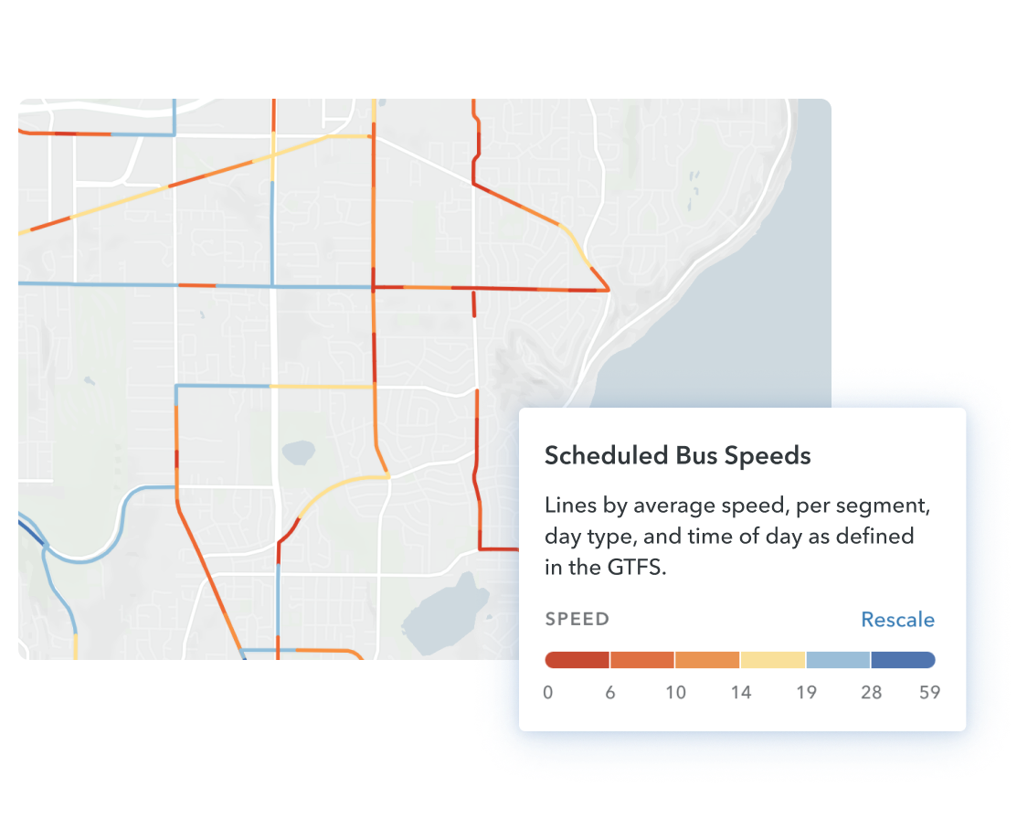
Quickly evaluate new proposals with purpose-built statistics from dozens of relevant data sets - no manual calculations required! Ask questions, gut-check with detailed census breakdown tables, and better understand the communities nearby that might benefit.

EVANSVILLE, IN

“Explore gives us a quick glimpse of relevant data. It's easy to look at Explore and get the information needed. And that saves us time.”

—Greg Shriefer, Transit Planner

essential employee neighborhood mapEssential employees per sq. mile
essential employee neighborhood mapadding additional microtransit service commentEssential employees per sq. mile

Curate the map to explore ideas or tell a compelling story

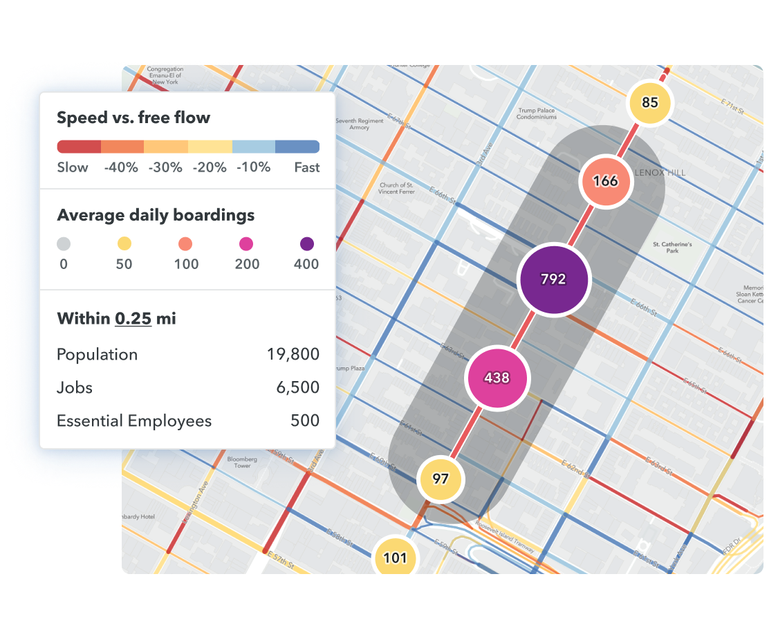
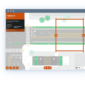
Estimate the scale of the solution and explore multiple concepts with instant demographic calculations before planning more detailed scenarios. Integrate equity as a first step in your workflow, instead of an afterthought.

Share ideas to gather feedback, build consensus, and move into action

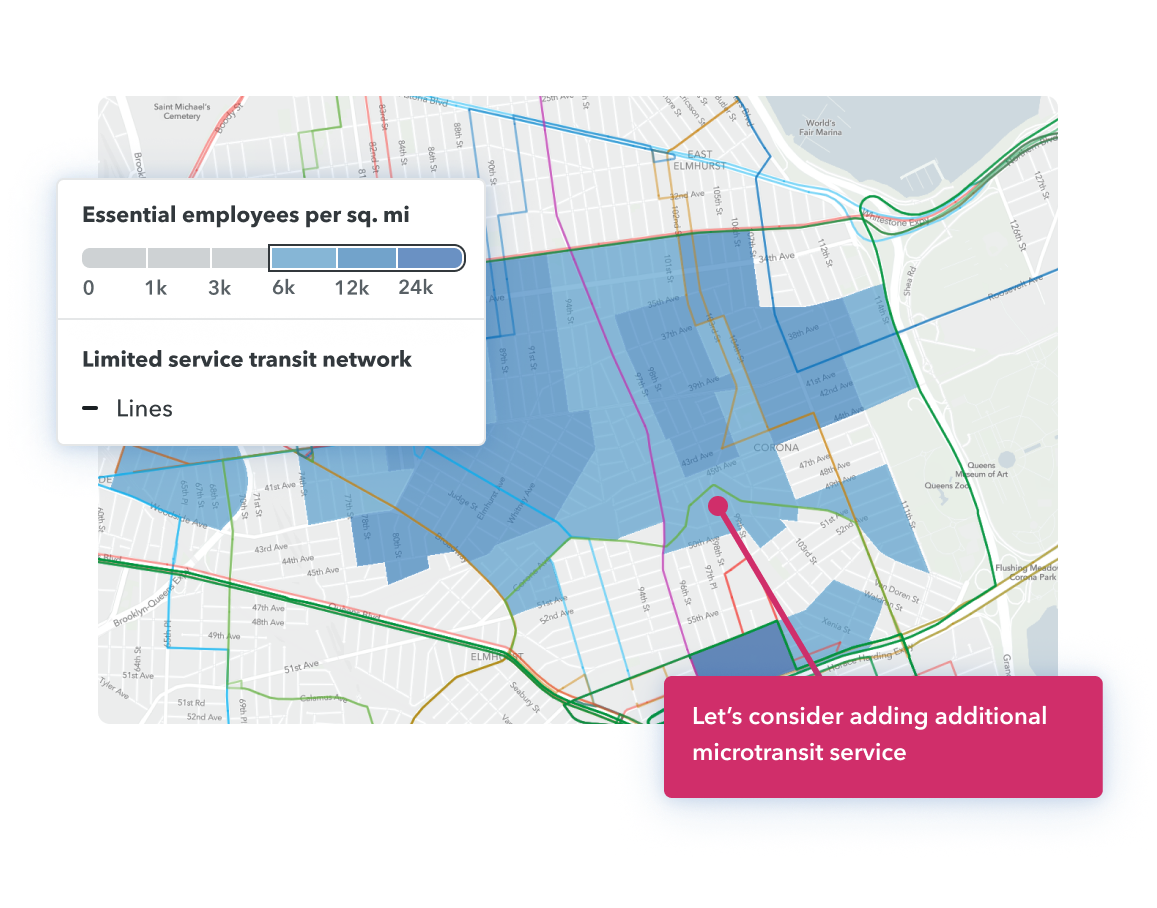
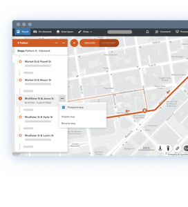
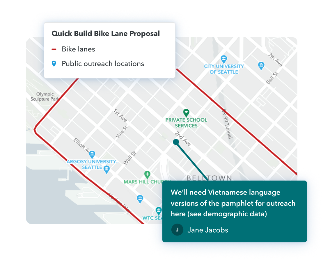
Curate beautiful data visualizations that communicate the logic behind your plans to bring internal and external stakeholders along the journey. Get feedback with commenting and collaboration across your projects.

GOTHENBURG, SWEDEN

From planning, GIS, engineering, and marketing, staff across multiple departments at Västtrafik use transportation and demographic data to inform hundreds of decisions every day democratize access to critical data.

transit mapcommentquick build bike lane proposal legend
blur mapData layer visibility access pop up

Control access to sensitive or non-public data

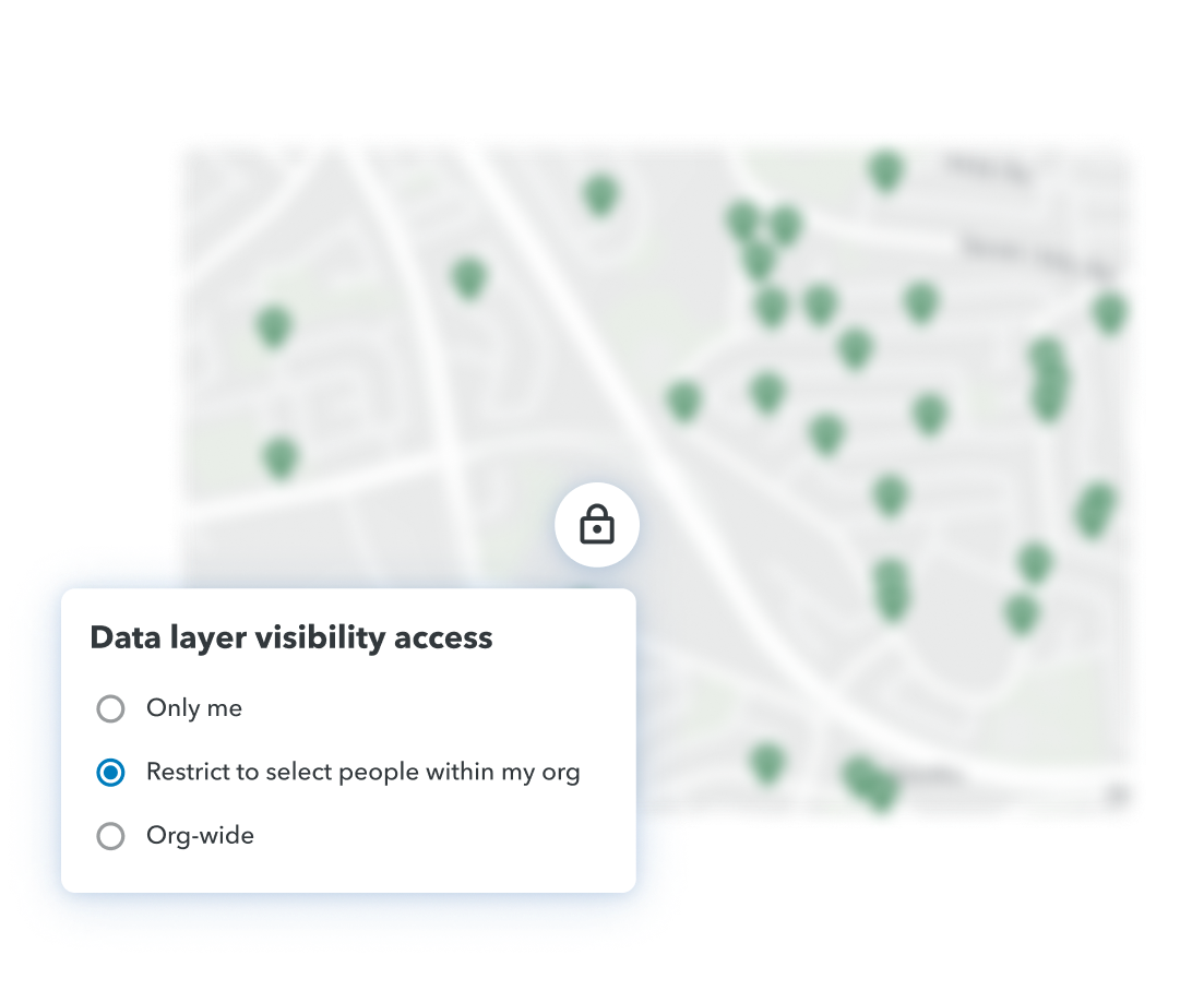
Configure permissions to ensure that the right individuals in your organization have access to sensitive data sets and take comfort in Remix’s track record in deploying industry best practices in our GIS software for safeguarding data.

Learn more about Remix solutions

This is just the beginning of how Remix can help. See more features and functionality specific to your needs by exploring and combining different solutions below.

transit solution

Transit

Plan your transit network from vision to implementation

Learn more
streets solution

Streets

Envision, plan, and design streets for the multimodal city

Learn more
shared mobility solution

Shared Mobility

Analyze and understand the impact of new modes

Learn more

Every Remix platform solution comes with:

wand icon

No installation

Remix is entirely cloud-based and requires only a computer and an internet connection.

team icon

Unlimited seats

An annual license covers everyone at your organization.

lightning bolt icon

Continuous improvements

New releases delivered automatically at no additional cost.

question mark icon

Unwavering support

We support you through your entire Remix journey.

brand expressionwheelchairbikerbus

Ready to get started?

Agencies of all sizes trust Remix to understand, plan, and coordinate their transit networks. Find out how Remix can help you.

Schedule a Demo