Street design software for the multimodal city.
Explore new street design concepts, make data-driven decisions, and move your early-stage transportation projects forward, faster.
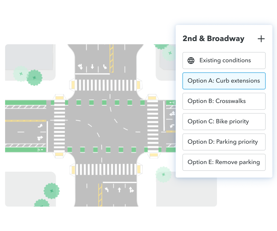
Let's talkDesign for the most vulnerable user, not the largest possible vehicle. Quickly propose safer intersections, protected bike lanes, curb extensions, and other treatments in a fraction of the time.
Redesign streets on the fly — in both cross-section and plan view, at the segment or network-level, in a conference room, or out at public meetings. Remix's street map making software gives you the visual tools to better support pedestrians, bikes, public transit, and cars.
Miami-Dade County, Florida
Aligning with a major resurfacing project, the Planning Division quickly designed and shared six new bike lane options with the Traffic Engineering Division. Together, they gained consensus and implemented in record time.
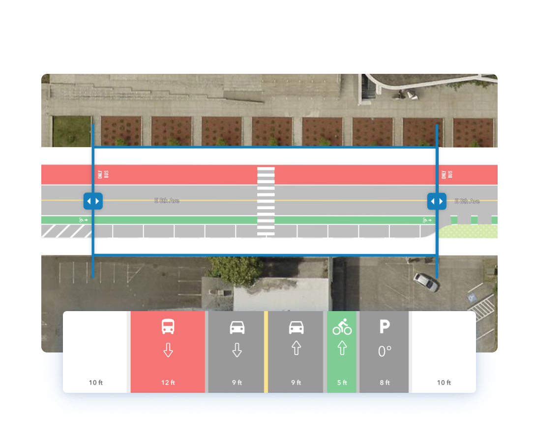
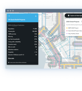
Incorporate relevant data around safety, curb inventory, existing and proposed bicycle networks, transit routes, origin-destination, movement counts, and more — so you can practice data-driven design in real-time.
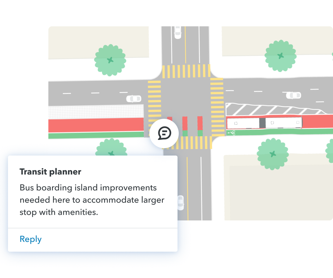
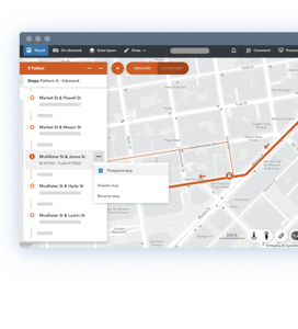
Transit moves more people in less space than any other mode. Quickly create conceptual plans for street-level changes to improve bus speed and reliability, and collaborate seamlessly with other teams.
Minneapolis, Minnesota
Using Remix, Metro Transit identified station improvement areas and designs how platforms fit into the intersection. Staff can now share alternatives for potential right-of-way changes earlier in the process.